
Today, we have a fantastic organization we’d love to spotlight, one that is making waves across the world in the fight to reduce plastic pollution, Eyesea. In our first #SaturdaySpotlight feature, we reached out to the founder of Eyesea to learn more about their new app and to have them share their story with us via a guest blog.
Intro
My name is Graeme Somerville-Ryan and I am the founder of the New Zealand based nonprofit, Eyesea. Simply put, Eyesea is an app that maritime sector workers use to record maritime pollution and hazards.
These data collectors will use the app to take photos of (and thus geo locate through GPS and timestamps) maritime pollution. The data will then be pulled into maritime charts and used to support ocean/harbour/coastal clean-ups and scientific research.
The backstory
As you all know, if you walk along a beach, whether it’s in India, New Zealand, the Isle of Man, or Canada, you find pollution. It occurred to me that there are a lot of pictures of marine rubbish on the internet, but few people put a location on them, and there is also very little public data and large-scale scientific research on marine waste either. So why not ask seafarers, the people who are out there every day, to post their pictures on a combination of Instagram and Google Maps so that we can understand the ‘spatial’ nature of the problem?
The good news is that Eyesea has attracted high levels of commercial ship owner and manager support with around 2000 vessels and recreational craft offered to the project Additionally, we have the support of the largest superyacht manager and two marina/yacht clubs have offered to help test the technology at the recreational level. Three flag states are involved, Liberia, the Bahamas, and the Isle of Man.
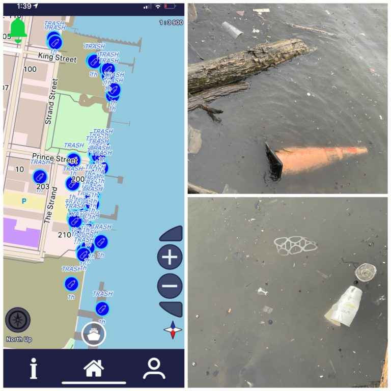
Photo: Oldtown – Alexandria, Virginia
What’s different about Eyesea?
Eyesea is not limited to maritime sector workers (anyone can download and use it), but this is where we have built our ‘unique selling point’. The feedback and support we have had from the shipping and seafarer communities has been unbelievable – from the executives onshore through to seafarers out on the ocean, everyone understands the problem and wants to do what they can to help. And this is critically important because, from what we’ve seen, we need everyone’s help to solve this problem and change behavior.
A key part of our strategy is to be as inclusive as possible. We have appointed around 65 maritime industry executives as Eyesea Ambassadors and approximately 20 At Sea Ambassadors – captains and crew currently sailing. These representatives come from Turkey, India, Pakistan, the Philippines, Italy, and Romania.
We are also working with community groups to collect data in India, Hong Kong, Canada, Chile, Brazil, Panama, New Zealand, Pakistan, Singapore, Greece, Sri Lanka, the US, the UK, the Isle of Man, Italy, Norway, and the Netherlands.
Thanks Canada – we owe you one
A large part of our early phase testing was done by Nancy Pearson in Newfoundland (aka @abagawalk) and more recently we have had a lot of data collected in Nova Scotia by the @scotianshores team. This data was operationally critical to our tech development but was also an eyeopener as to the extent of the problem. While I’m sure this is no surprise to you – it was to us. Further proof of concept that we needed global data to show ocean pollution is very much a local issue.
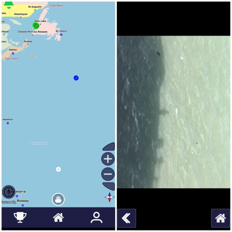
Photo: Atlantic Canada
Where to from here and what do we do with the data?
Eyesea was set up in December 2020 and in a relatively short period of time we have made some pretty good progress – with a focus on the power of data:
- The Eyesea app went live on the Play and App stores around 6 weeks ago.
- We have just signed an agreement with a major tech company to work on AI analysis of the Eyesea imagery (focusing on pollution identification and density analysis).
- We have agreed to provide a small amount of funding to support a clean-up nonprofit in India based on some significant data collection. We hope this will develop into a long-term relationship.
- We are scoping out a project to map Manila Bay in the Philippines – providing data to support the use of recovery craft run by another nonprofit.
Want to help?
Maps change everything. They show a problem in a very clear way, a way that is hard to ignore. Every data point collected means something (it also has an embedded image on our map). We believe our job is to help organizations like Plastic Oceans Canada – to help you visualize what you are seeing out on the beaches and coastlines.
I am really excited about the future and potential of Eyesea. Not because it is something I have worked on (non-stop for 18 months), but because I believe the data we collect (or you collect) and bring a wide range of organizations and people together. People who would never usually cross paths.
And this is important because it’s too big a job to solve alone.
Drop me a note if you’d like to be involved. graeme@eyesea.org
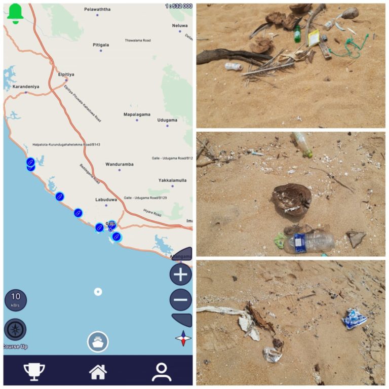
Photo: Galle, Sri Lanka